NB: If you didn’t see a post yesterday, it’s because there was some issue in its getting scheduled. Probably the issue was me not hitting the button once I finished it. Anyway, go back to the previous post if this one seems out of order.
This last week through the desert keeps giving me flashbacks to last December, my last week in the desert of Southern California. The terrain is more dramatic here–what with its volcanic origins on full display–and it has far fewer people recreating in it–I met no others on this day, not even a single cow–but there are enough similarities to conjure up the same feeling.
In particular, the weather is the same. It was a beautiful sunny day all day, but it was never hot enough to seriously break a sweat. The way the clouds do is the same. The rapidly vanishing contrails of the jets. The colors of the sunset. The vast expanse of stars coming out between the end of dusk and the rise of the waning moon.
When I was in the desert south of San Jacinto, headed for the Mexican border, I came across civilization almost every day. Here there was a restaurant just off the trail, here there was a little town with a tiny house for rent, here there was someone’s house with a water tank I could draw from.
It’s not quite as posh in this desert, but there is still a lot of civilization to be seen beyond the ever-present footprints of the sobos just ahead. I could see the highway from the edge of the mesa I woke up on at first light, once I put a good 45 minutes into stitching up my gloves and could come out to see the world as I packed. The distance passing trucks came into and out of view throughout the day, depending on the height of the trail and what features obstructed the line of sight.
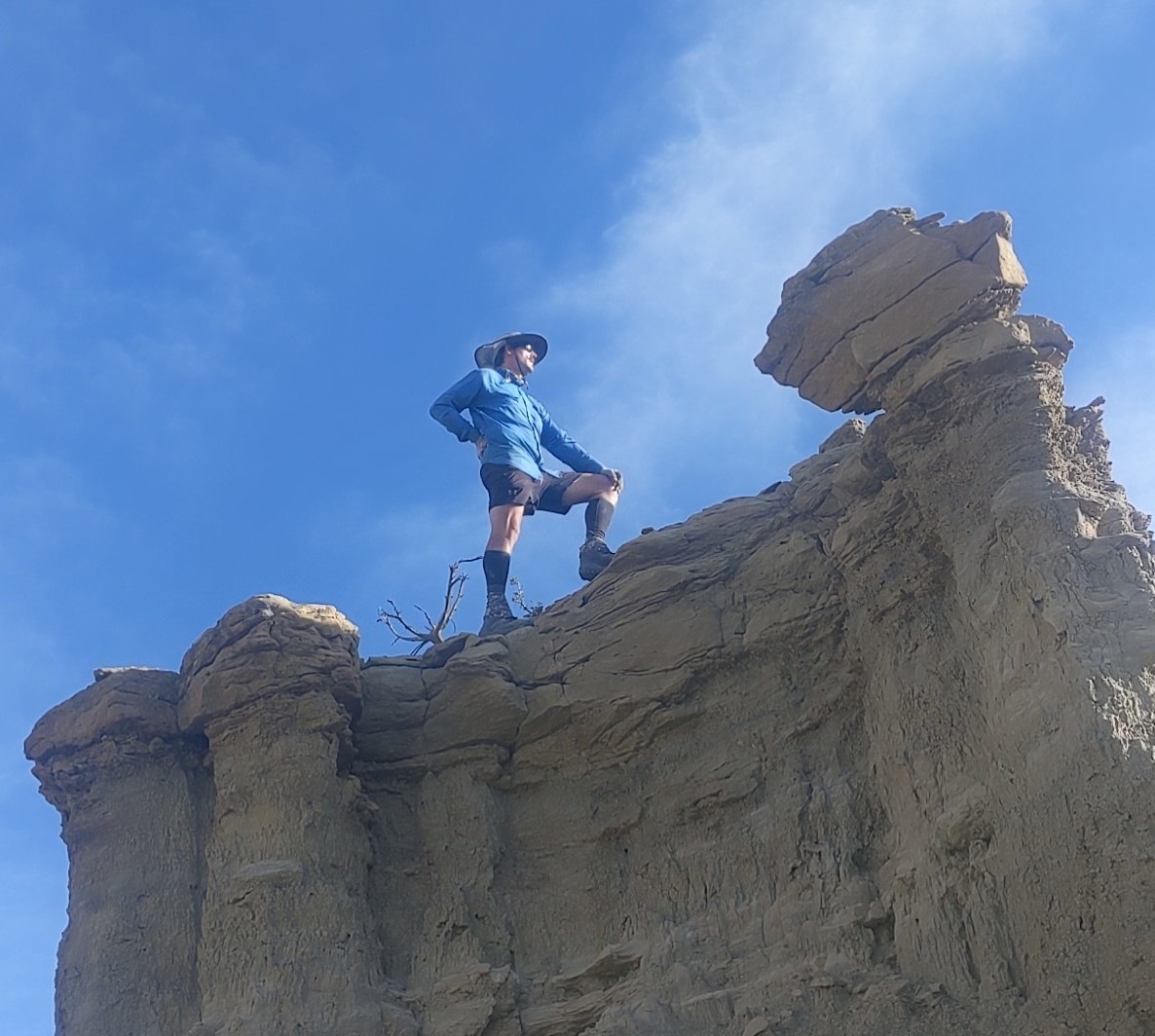
And whenever the road could be seen, my phone could see distant cell towers. I tested this fact once in the morning, to share with a friend the photo I had just taken and which you saw as the featured image on this post, and once in the evening during dinner, to download an album and some podcasts I planned on listening to and to share the images of the sunset you see below.
The water I encounter out here is just as much of a sign of civilization as it was at the southern end of the PCT. I passed up another cache this day, 15 gallons left near a major road crossing, to go on to another source, a spigot connected to a mains supply in the middle of nowhere surrounded by mostly empty metal tanks and hoses that could be used to fill them. There was a single tree among them all, so I Jerry-rigged a chair and ate lunch underneath it before filling my water bag and walking out over a wooden box bridge some human had dropped across a deep chasm nature had carved through the canyon.
What I never saw in California is rock formations like the volcanos, rain, and wind have left across this landscape. My best guess is that volcanic ash built up and compounded into the loosest, crumbliest rock imaginable before thick lava flow covered it in hard weather-resistant protective layers. And where that hard rock has been undercut and toppled, the soft stuff it protects has been quickly washed away. This accounts for the steep, step-like edges of the mesas, and for the temple-like columns that I tried to climb but couldn’t due to the lack of footholds and exposure near the top that is beyond my skill and confidence level as a climber. I could get close enough to see how easy it would be to tree myself like a scared cat if I got any further.
The PCT also didn’t subject me to barbed wire fences across roads that had been thoroughly wired shut, forcing anyone passing down that road that crawl under or climb right through the fence after throwing their pack over. That just has to happen every once in a while out here to remind us that this is the CDT, which is not a Piece of Cake Trail.
It’s not hard to find views to take pictures of even where there is less wildlife than there has been recently. Don’t get me wrong. There is still wildlife. I saw a rabbit the previous night, and there are occasionally small critters like chipmunks, beetles, tarantulas, plenty of ants at dinner. And I go to sleep and wake up to the sounds of distant coyotes most nights. But I had gotten used to seeing critters almost all the time, particularly birds. I woke up this morning to the sounds of birdsong all around, but they had all flown off elsewhere by the time I emerged. I saw very few the rest of the day. Anyway, the point is, I’m constantly seeing the shapes of the rocks, the way the storms and snowmelts have carved it through the years, the way the trees and shrubs and cacti have decided to grow on and through those formations, and it is just as attention-grabbing as all that wildlife was.
And the human influence somehow draws even more attention to the state of nature. A single yellow deciduous tree grows behind some “tanks”–ponds dug in the valley to be kept filled for the cattle. Some abstractly twisted trees are marked by discs of sheet metal painstakingly hand-punched with a series of holes depicting a version of the CDT logo. Shafts of steel rebar restrain rocks on the steepest climbs highlighting the fundamentally fragile nature of these rock formations. Cairns serve to mark the incredible viewpoints the trail passes just as much as they mark the trail’s route.
I had a goal for the day and I achieved it. I surpassed it, modest as it was. I got where I wanted to get to. I needed miles to make sure I made my reservation in Grants. But I wasn’t always eager to get hiking. Even on a day with such perfect hiking weather in a section with mostly gentle easy-to-traverse terrain. I stopped for a break in a tree’s shadow in the afternoon and, even with a cold wind urging me on, I sat still for 45 minutes. I just didn’t want to be on my way, on my feet. I had stopped to smell the roses, as it were, and I didn’t feel like starting again. Maybe I just need others around to motivate me, or maybe I’m just being dilatory because I know I won’t be out here in another week and I’ll probably miss it.
Well after dark, by the light only of the stars and the Milky Way, a distant light on the highway, and my headlamp on its dimmest setting, I passed my landmark that I had decided the previous night I must pass this day. And I actually felt good. I wanted to keep going for a while. Not just for a mile, but for even another half mile after that. All the way until 8, a half mile later than I’ve been stopping. I went down a ridge that I bet would have been beautiful by daylight and into the flats. I found a nice site until a lone tree somewhat off the trail, and finally got off the feet that had been paining me half the day.
I took off my left sock to tape up some hot spots before I got ready for bed. I noticed that my left pinky toenail was now completely gone. Not that I need it or anything, but that certainly never happened on the PCT either. Maybe it’s time to end this hiking season after all.
Trail miles: 18.5
Distance to Grants: 65 miles


One reply on “Day 169: Near San Luis Road”
This might be my favorite blog post. It really gives the reader a feeling for why one might fall in love with hiking. Written for one to “see” the beauty through your words.