I was awake by 5 and started packing by 6. One Day and I were both ready to roll out at the same time a bit after 7, but we would not be together most of the day.
She stopped to collect water at the first water source, having used the last of hers at breakfast, but I had plenty and pushed ahead. Within the hour, the call of nature sent me off the trail and into the woods above it. She passed me soon thereafter. When I returned to the trail, I was a solo hiker again.
Within the hour, the snow started to fall. The morning had been nice and clear, but the day didn’t feel like waiting around on its promised nasty weather. I stopped to put on my Packa. But the snow was sticking to my gloves, so I stopped again shortly thereafter to get out my glove shells.
The snow started and stopped several times during the next two hours until I finally descended to the junction between the low route and the high route. The high route was considered more scenic and was the official CDT route while the low route was considered safer in bad weather, and the weather wasn’t great.
But the snow was just a light dusting when it happened and the sun did occasionally deign to shine through the clouds. One Day had indicated the high route was her preference and I agreed, so I didn’t hesitate to head that direction. I did hesitate, but it was only to take a snack break and not related to deciding which way to go.
A few miles up the trail, One Day came running up behind me asking if I’d seen her note. She had flip-flopped on going high or low several times and eventually come back to the high route. We hiked together for a bit, then stopped at the Texas Creek crossing, where I wanted to make a drink and take off my coat for the big climb ahead. I told One Day to keep hiking, then saw nothing but her footprints for the rest of the day.
It was a serious climb. Not particularly steep, but always up. The sun sort of came out a little after two, so I stopped on a rock sort of in it for lunch.
Around 4, I came out of the trees into the shadow of a ridge where a cold wind was gusting. I surmounted the ridge and came out into the direct sun and the direct contact of that intense West wind.
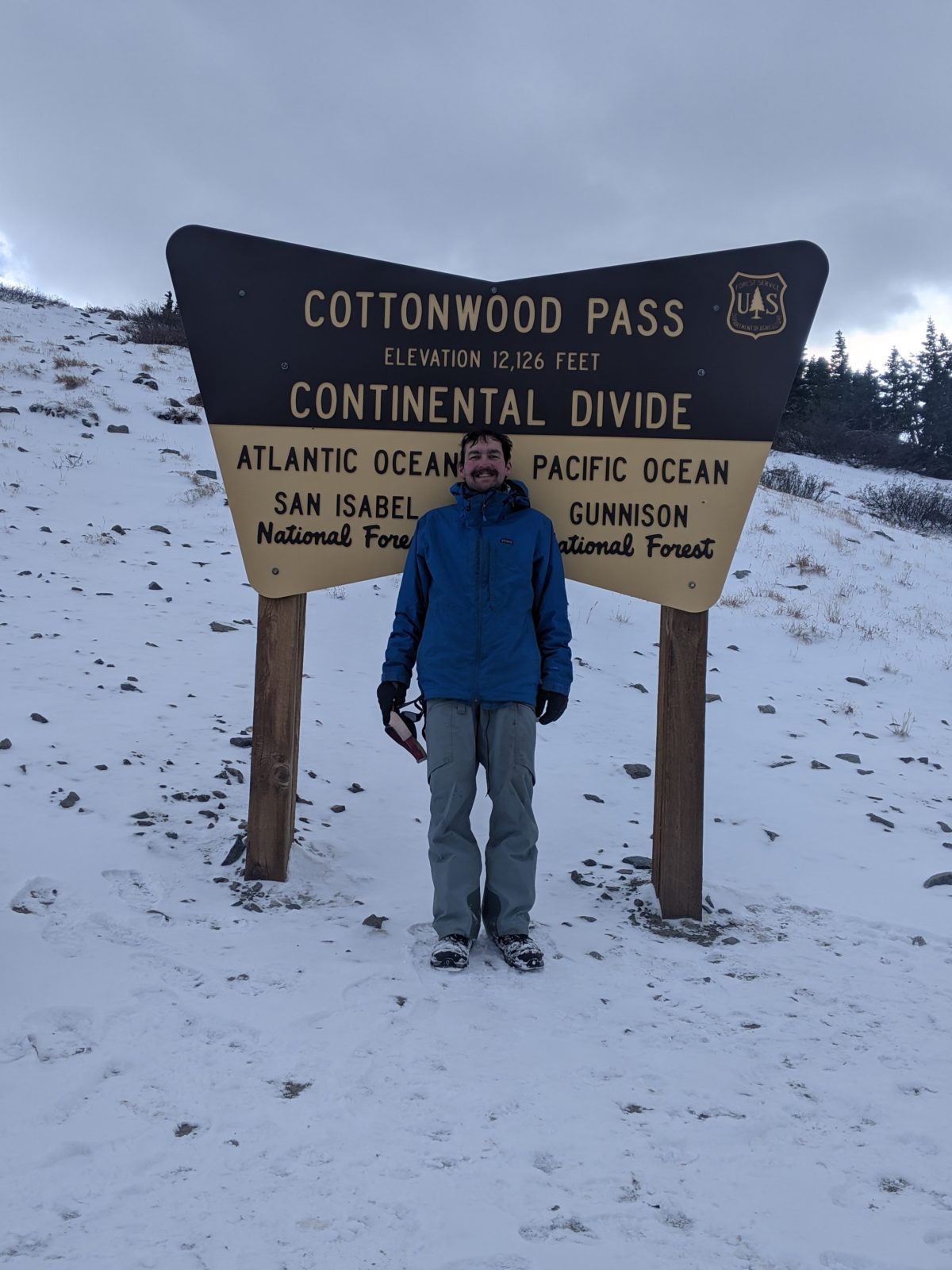
I descended into the Cottonwood Pass parking area where there was a small pond just down the hill. I fetched some water from it, then got a picture with the sign from some women hiking down a short summit trail for day hikers.
The snow in the trail became thicker beyond this point. Although I skipped the day hike summit, I had to summit the much taller peak behind it to get onto the high ridge of the Sawatch Range that is the Continental Divide.
Although the signs said don’t cut the switchbacks, the snow was so deep in the trail that it was much easier to climb straight up the rocks and ignore the trail. It was still a long climb, but when I reached the top I had a great view of the dark clouds that had finally reached me.
Down onto the ridge I went as the world became whiter. Though I had a couple of hours of sunlight to work with, I could not see the sun. I was being pelted by bits of ice on my right side as long as I was on the west side or top of the ridge. I thought I would get some relief when the trail switched to the east side, but there was some wind there too, coming up from below or down from above. And it was another long climb when I was already tired.
I could see from her footprints that One Day had put on microspikes. I had not. I seemed to be doing fine without them, and putting them on meant standing in that cold wind with one less layer on while I got them out of my pack. The prints became clearer as I came up onto the windswept ridge again. Parts of the next mile and a half were completely blasted by wind. There were no views. Just a light fog.
I had originally been planning to stop at a supposed wind-protected campsite at the next major shoulder of the mountain, but it seemed very unlikely that wind protection could do anything about this wind as long as I was on the western slope. I was thinking about going on another three miles back over the ridge and down below treeline on the eastern side. Then I heard One Day coughing down in the trees where I had been thinking of stopping. I called out to her and she confirmed the wind was actually calm down in those trees.
So we set up tents right behind trees. It wasn’t perfectly flat or anything, but it wasn’t particularly lumpy under the snow either. We cooked in our tents and settled in for a cold night, me by filling my water bag with boiling water and slipping it under my coat inside my bag. As I was doing all the boiling of water for supper and my hot water bag, snow kept blowing in under my rainfly and into my tent. There was no way to keep it out without closing the flap, but I needed to keep the flap out of the way of the stove. So I just kept brushing it back into the vestibule.
The snow kept coming. I was warm and comfortable for the moment, but several inches of accumulation meant a miserably slow hike the next day. But there was nothing to be done. I had food for several more days. I just needed to go 28 more miles. It could be done.
Trail miles: 17.6
Distance to Monarch: 28.1 miles


