I first snapped awake around 4am at the sound of two consecutive explosions. Like propane canisters popping right next to me or distant blasting. Or maybe more likely gunfire echoing hollowly down the canyon.
I got back to sleep again somehow. I slowly started waking up and packing around 6. By 7:15, I was nearly packed and Ted was still asleep. I woke him up. I walked out at 7:30 sure he would catch up to me soon.
I finished climbing the road up to the old mine. We had been seeing evidence of mining operations all down the valley, but nothing as decrepit as this. Just before reaching it, I was passed by a jogger who ran right up to the steep face of the ridge at a loose rock scramble on the corner, paused for a drink, then began climbing it at unbelievable speed, like young Bane escaping the oubliette in Dark Knight Rising.
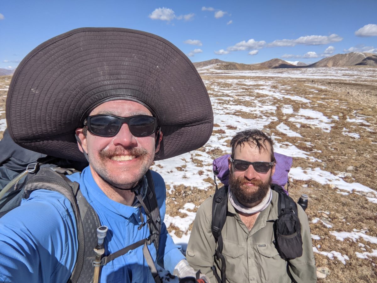
I walked up to the collapsed mine building, happy to finally be in the sun. After nothing but cloudy mornings for most of a week, a clear day was a blessing. I removed my coat and snow pants, put on my sun hat, and slathered on the sunscreen. While I was doing all this, Ted caught up to me.
We had a nasty climb ahead of us. To begin, we climbed straight up a pile of rocks sized perfectly for such climbing. There were only a few sketchy spots further up, but nothing incredibly exposed. Walking diagonally up the grass toward the lowest part of the ridge, we eventually arrived at a faint trail that was probably actually the official CDT. It was mostly easy, but right before the top of the ridge, there was the section labeled “Dangerous Traverse” on Guthook. A steep, sandy backslope that was completely exposed. It wasn’t really possible to skip it by climbing up. That was just as sandy and sprinkled with loose rocks ready to fall when you try to step on them or use them to pull up.
Right at the middle of the traverse, the trail, such as it was, was completely missing. I avoided it by climbing up onto the protruding rocks above it: an outcropping of shale, half of which was ready to fall at the lightest touch. In fact, my trekking pole loosely brushed one such rock sending it freaking straight into the side of my knee to perform a very painful and bruise-inducing collision. But it didn’t jar me loose, and I managed to safely crawl to the other end where it stop being exposed.
Once gaining the top, we still weren’t at the top of the correct ridge we wanted to travel. There was a road now, at least, but it steeply zagged up another long climb. As we approached, the insane jogger descended and went off the road right into the rock slide where he had come up. In the fifteen seconds it took us to reach the spot where he’d gone over the side, he had disappeared. He must do this route a lot. Probably one of them ultramarathoners.
Once we reached the top of that next climb (with several photo and breath stops along the way), we came to a junction and took what appeared to be a shortcut road still climbing the hill. At the top of another climb, I called for a snack break, but we then learned that road wouldn’t connect, so we took another steep and even less traveled by road through the snow to finally gain the top of the ridge. In a bit over 2 hours, we had climbed from 11461 feet of elevation up to 13061. 1600 feet up!
So what did we do next? Climbed over Santa Fe Peak. This was just the first of many peaks we climbed as we moved along the ridge throughout the day. There was Geneva Peak right after (another snack break). Followed by a snow field below the summit of Landslide Peak. Then we made a steep descent to a road that led us over a steep hump and down into Webster Pass. There were a lot of dirtbikers here and a guy in a big 4WD SUV that rolled down his window to give us props, but my yogi game was off so I didn’t even try to get anything else.
Next was Handcart Peak, which we only partially climbed before following the trail on a traverse along the side. This brought us to Radical Hill (which I guess is named because it is vaguely shaped like part of a square root symbol) and a road down and around it where we were constantly passed by off-roaders. One RZR was being driven by a little girl while two old men got to just enjoy the scenery. A climb back up the ridgeline put us directly in the path of a sharp cold wind. We decided to stop for lunch as soon as we could get out of the wind.
That didn’t work out. We climbed down a bit from the trail in the next pass, which was ruled by dirtbikers practicing their hill climbing to where a big pool of water was constantly maintained by snowmelt. There were plenty of places to sit but none sheltered from the wind, so we just put on our jackets and ate lunch. Clouds chose that exact time to start blocking the sun on a regular basis. I wanted a time machine to send them back to when I was walking across the New Mexico desert. In the shade, the wind could cut right through my jacket.
I took it off after lunch in preparation for two more climbs. The clouds cooperated by letting me have the sun while I crammed it into my pack.
The next climb was on the road, steeply up to the corner where the road left the ridge, then across the snow on the way to Whale Peak. The first part of this climb was around and over a steep rock pile, echoing the sort of work we’d done the previous day. The rest of the climb up Whale Peak was just an easy cruise in the snow.
The last climb of the day was Glacier Peak, a mile away over the ridge. Ted led the way to the trail but some animal led left prints in the snow along the trail up the hill. It was a steep climb but not technical, and we reached the top around 4pm. We stopped to don jackets again since the cold wind was still blowing and there would be no more big climbs to warm us up. From here we had 7 more miles to the river, almost all downhill.
We followed an old road undergoing restoration to a more natural state down to the saddle before Georgia Pass. The trail followed the road up to the trail crossing then down again along a parallel track. We just walked across the road and hit the track a hundred feet away cutting off the pointless climb.
We didn’t know it yet, but we were now on the Colorado Trail. It worked its way back along the side of the ridge we had just descended to one of the lower ridges radiating northward from Glacier Peak. After being above treeline all day, we were thrust back into the forest quite abruptly. We descended this ridge, eventually taking a long series of switchbacks into Missouri Gulch as the light faded.
Ted got a bit stumbly and slow toward the end of the descent, but I could still make out the trail obstacles just fine. And more importantly, I didn’t want to stop and remove my pack to get out my headlamp until we were done. At the very last twinklings of twilight in the trees, nearly 8pm, we came upon a creek and a small footbridge. Since Ted had his headlamp at hand, I asked him to put it on and look around us for camping. There was nothing good visible, but then I saw another side trail and went down it to find a nice little cleared campsite near the stream.
I started with filtering water and exploring the area while Ted set up his tent. He hung his bear bag in the woods while I set up my tent, piggybacking off of one of his stakes. He was done for the night and I hadn’t even started dinner.
I sat on a log beside his tent and made supper. While it cooked, I crawled into my tent and put on a few more layers of clothing. By the time I was done, maybe a liter of water had finished filtering, but I packed up the filter and took it to bed with me. It was not going to be as cold a night as the last two, but it would still be pretty cold.
Trail miles: 19.5
Distance to Frisco: 30.3 miles


One reply on “Day 148: Middle Fork of the Swan”
Y’all are beasts!